Table of Contents
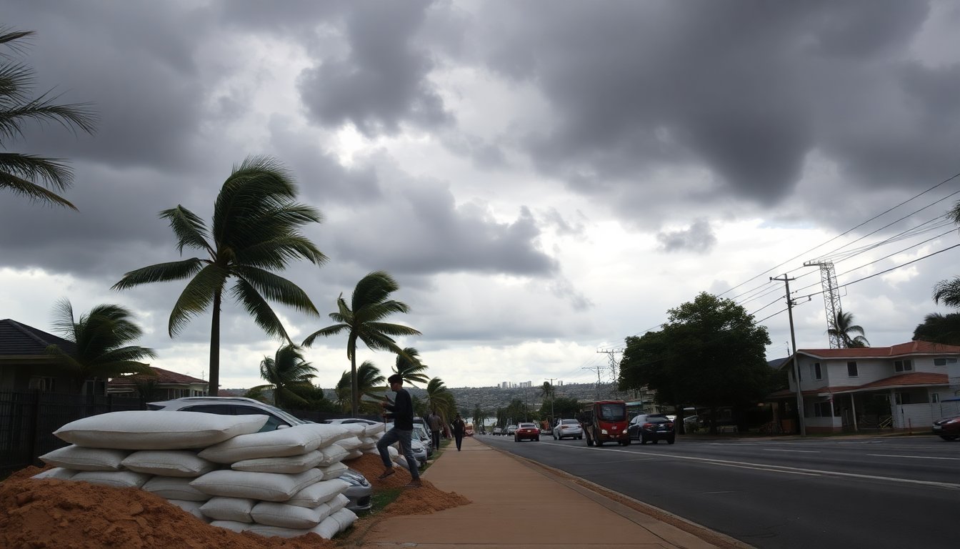
The Northern Territory of Australia is facing a serious situation as Tropical Cyclone Fina approaches the region. Residents are urged to take necessary precautions as the cyclone is expected to bring destructive winds and heavy rainfall. The Bureau of Meteorology (BOM) has classified Fina as a Category 3 cyclone, with wind gusts reaching up to 165 kilometers per hour (102 miles per hour).
Fina is currently located in the Van Diemen Gulf and is predicted to impact the Tiwi Islands and Cape Hotham by Saturday afternoon. As it progresses, it is likely to pass just north of Darwin, the capital city of the Northern Territory, later that evening.
Preparing for impact
In light of the impending cyclone, the BOM has advised residents to continue their preparations. This includes securing boats, property, and ensuring household emergency plans are established. Meteorologist Dean Narramore emphasized that even if the cyclone does not make direct landfall, it will still bring widespread heavy rainfall and strong winds, particularly affecting Darwin, which has a population of approximately 140,000.
The seriousness of the situation
Kirsten Engels, the incident controller at the Northern Territory Emergency Operations Centre, highlighted the need for readiness, stating, “We are prepared, but the situation is serious.” As winds and rain intensify, residents in affected areas are encouraged to seek shelter and remain indoors.
The approaching storm evokes memories of Cyclone Tracy, which devastated Darwin on Christmas Day in 1974, resulting in the loss of 71 lives and extensive destruction. The aftermath required significant evacuation and reconstruction efforts, making it one of Australia’s most catastrophic natural disasters.
Current cyclone status and warnings
As of Saturday afternoon, the cyclone was located approximately 65 kilometers north-northeast of Darwin. The BOM has issued a cyclone warning for Darwin and surrounding areas, including the Tiwi Islands and parts of western Arnhem Land. The cyclone is moving west-southwest at a speed of 9 km/h and is expected to bring sustained winds near the center of 140 km/h, with gusts potentially reaching 195 km/h.
Anticipated weather conditions
The BOM anticipates a rapid deterioration of weather conditions as Cyclone Fina approaches Darwin. Residents are warned that the evening could bring intense wind and rain, particularly affecting coastal areas such as Casuarina, Nightcliff, and Fannie Bay, as well as the Tiwi Islands community of Wurrumiyanga.
Despite the cyclone’s trajectory coinciding with high tide, BOM officials indicate that a significant storm surge is not expected for Darwin. However, damaging waves and heavy rainfall could result in localized flooding, especially around creeks and coastal regions.
Advice for residents
Superintendent Engels has urged the community to remain calm and adhere to their emergency plans. She stressed the importance of staying indoors until conditions stabilize and advised residents to monitor updates from the BOM and local emergency services.
“We’ve had days to prepare for this, and there’s no need to panic,” she stated. “We are ready, and we’ll get through this together.” Residents are encouraged to maintain communication and stay informed about the cyclone’s progress.
Fina is currently located in the Van Diemen Gulf and is predicted to impact the Tiwi Islands and Cape Hotham by Saturday afternoon. As it progresses, it is likely to pass just north of Darwin, the capital city of the Northern Territory, later that evening.0