Table of Contents
On March 16, 2026, a substantial winter storm moved across Ontario, delivering heavy snowfall, rounds of freezing rain and strong winds that left many communities grappling with disruption. The system covered a broad area from Sault Ste. Marie and Elliott Lake through Sudbury and up toward Timmins, prompting Environment Canada to maintain an orange alert for a large swath of northern Ontario. Local reports and meteorologists described the event as historic for the region, with measured accumulations and secondary hazards that extended impacts well beyond the initial snowfall.
The storm shifted in intensity and type of precipitation as it progressed, meaning some places saw mostly snow while others experienced a transition to ice pellets or freezing rain. That mix increased the risk of damage to trees and power infrastructure and made road surfaces extremely slippery. Municipalities declared significant weather responses, and utilities warned of possible prolonged outages. Officials urged residents to stay home unless travel was essential and highlighted the increased dangers for those working outdoors or driving on rural highways.
Storm totals and forecast details
Across the hardest-hit corridor, measured snowfall reached an estimated 30 to 50 centimetres in many locations by midday on March 16, 2026, with some pockets reporting totals close to 50 cm. Environment Canada had initially predicted 10–20 cm in some areas, but changing storm dynamics produced heavier accumulations, particularly between Sault Ste. Marie, Elliott Lake and Timmins. Forecasts also warned of an additional six to 12 millimetres of freezing rain for parts of the Greater Sudbury area, where ice accretion compounded the weight on branches and power lines.
Precipitation types and timing
The system commonly began as rapidly accumulating snow before switching to periods of freezing rain or ice pellets in several communities overnight. Environment Canada described the precipitation change as likely to reduce total snow depth in some zones where the storm briefly warmed, but the combination of heavy snow followed by ice was the main driver of infrastructure stress. Meteorologists expected the bulk of the event to taper to lighter snow overnight, yet cautioned that dangerous travel conditions would persist.
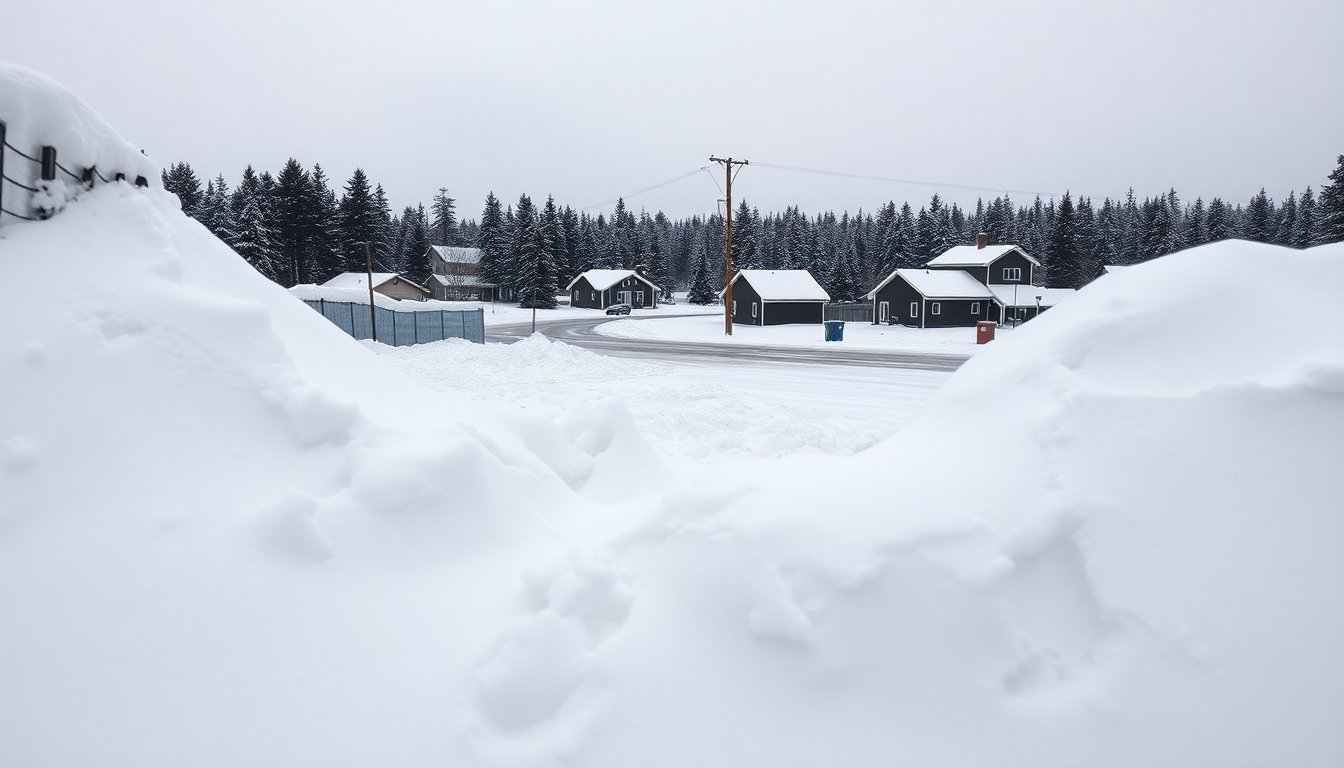
Community impacts and infrastructure strain
Municipalities reported significant challenges clearing roads and maintaining essential services. In Sudbury and on Manitoulin Island, residents documented deep drifts and a glazing of ice that left many properties and agglomerations struggling with mobility. Crews were fully deployed to prioritize major routes, but city statements made clear that many side streets would not be serviced except for emergencies. Utilities such as Hydro One and local providers recorded outages affecting thousands of customers in the broader northeast region, and damaged lines and sagging branches were frequently mentioned as contributing causes.
Schools, mail and critical services
Several post-secondary institutions and colleges across the northeast closed campuses for the day, and Canada Post issued red delivery alerts suspending mail for affected areas until conditions improved. Hospitals adjusted schedules, canceling some procedures, and emergency services asked residents to limit non-essential travel. The provincial highways experienced closures across stretches of Highway 11, Highway 17 and others, with police advising motorists to avoid travel unless necessary. These measures reflected both immediate safety concerns and the likelihood that clean-up and service restoration would take extended time.
Safety guidance and recovery steps
Authorities emphasized practical precautions: clear exterior exhaust vents to prevent carbon monoxide buildup, keep generators outdoors and away from windows, and treat any downed wires as live to avoid electrocution. Fire departments reminded residents that if a carbon monoxide alarm sounds, occupants should leave immediately and call 911. The City of Greater Sudbury declared a significant weather event and asked people to remain indoors while crews focus on clearing main corridors and restoring priority services.
What residents can do now
Officials recommended preparing for potential short-term outages by keeping batteries and charged devices ready and having an emergency kit accessible. Drivers were told to delay travel until highways reopen and to carry blankets, food and water if travel is unavoidable. Community radio and local emergency channels were cited as the best sources for up-to-date information as crews and utilities work through the aftermath of the storm.
Looking ahead
While the immediate storm impacts dominated headlines on March 16, 2026, forecasters warned that subsequent flurries and localized lake-effect snow squalls could continue to affect southern and central parts of Ontario, including the possibility of strong gusts along the lakeshore. Residents and travelers were advised to keep monitoring Environment Canada bulletins and follow local emergency messages until normal operations resume.